Between Private Rain Barrels and Public Catch Basins: Networking Neighborhoods to Stormwater

November 30, 2015
Lots of Angelenos wants to know what they can do to prepare for El Niño. How do I make sure my hillside is safe or my street won't flood, for example? In addition to protecting property from flood damage, there's a long-term water supply benefit to preparing for El Niño, this one or future El Niños. When a drought-prone region gets soaked by intense storms, how can we capture and bank those water surplusses and save them for dry periods?
Stormwater is an asset for recharging our underground reservoirs known as aquifers. If LA's neighborhoods were designed to slow down stormwater runoff and percolate it into the ground or store it in a network of cisterns, we would build a "savings bank" of water, reducing our dependency on dwindling snowpack in a warmer climate.
We can capture small amounts of stormwater as private citizens, through rain barrels and permeable landscaping. And we can capture stormwater as a city, through a small number of large catch basins (LA County Flood Control), retooled storm drains (Bureau of Sanitation) and a new approach to permeable schools and parks (LADWP Stormwater Master Plan). But we can catch a lot more if our neighborhoods work together strategically, on property that is both public and private.
Due to topography, geology, and land uses, some neighborhoods are perfectly positioned to sink water back into the ground and help build up LA's local water supply. Streets, homes, and businesses in those neighborhoods can be retrofitted or designed to soak up and infiltrate water into aquifers. Other neighborhoods are not appropriate for infiltration—the geology is not right, flooding is a risk, or contaminants beneath the city might spread. Streets, homes and business in those neighborhoods can be designed to soak up storm water and store it in manmade systems.
Using Hazel, a new tool in development by the Arid Lands Institute with partners at Perkins+Will, Arup, and City of LA Bureau of Engineering, Connect the Dots introduces neighborhoods to the SPECIFIC data relevant to their homes, streets, and businesses. With information that is particular to locations down to 900 square feet, citizens can see where its best to infiltrate into the underground basin, and where its best to capture water and hold onto it.
Is your neighborhood ready to understand which Hydrologic Zone it belongs to? Preparing for El Niño 2015, and future large rain events, is an opportunity to look at flood control and water supply together, converting one threat (flooding) to an asset in the face of another (drought).
Through Connect the Dots, we've been introducing Hazel to LA, one neighborhood at a time. Teams from ALI and Connect the Dots are available to present to your neighorhood council or your HOA, or run workshops in partnership with your school, organization, or council district.
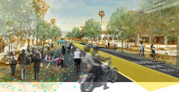
Want to find out more? Join us on Saturday February 20, 1 pm to 9 pm, for Connect the Dots | Van Nuys, a free, public design workshop and street festival on Van Nuys Boulevard between Sylvan and Erwin. A project of Divining LA and Mayor Garcetti's Great Streets Inititiative, Connect the Dots provides tools for Los Angelenos to reimagine LA’s Great Streets performing at their fullest potential: serving as engaging public spaces; healthy, active transit corridors in lively economic zones; and strategic groundwater assets.
Recent posts
February 15, 2018
February 12, 2018
February 12, 2018
Archives
- July 2020 (1)
- February 2018 (4)
- August 2016 (1)
- July 2016 (3)
- April 2016 (1)

